“The forecast isn’t great for today,” said our host, Jo, as we ate breakfast. That was a nice way of telling us it was going to be a long, wet walking day.
From our table in the sitting room where we enjoyed a healthy breakfast (fruit! porridge! yoghurt!) we watched a steady trail of hikers pass by, all wrapped in waterproofs, their backpacks encased in a variety of luminously-coloured rainproof covers.
“There go the Terminators.” Husband gave the elderly Canadian ladies this nickname ‘because they just don’t stop.’
“We won’t see them again today.” (Spoiler alert – we didn’t.)
Soon it was time for us to leave, also wearing full waterproofs, also with our backpacks in their rainproof covers.
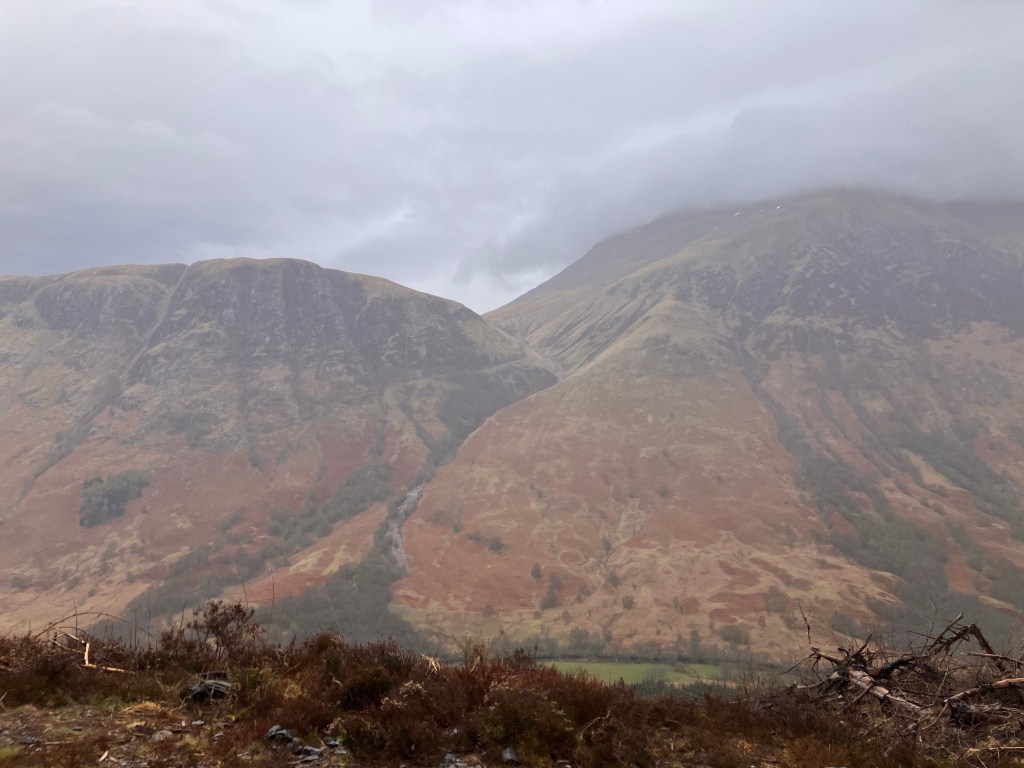
Today, we knew, would be a long day, but relatively easy for most of the way. We just had to face the climb out of Kinlochleven first. This was steeper but also shorter than the Devil’s Staircase, and soon we were up high enough to look back down on Kinlochleven. The rain had been constant and the low cloud indicated it was not going to stop anytime soon. (Spoiler alert – it didn’t.)

“There’s a bus from Kinlochleven to Fort William,” I said, a little sadly.
“What? We didn’t have to walk today in the rain? We could be in Fort William having a beer?”
No bus for us. Only walking.
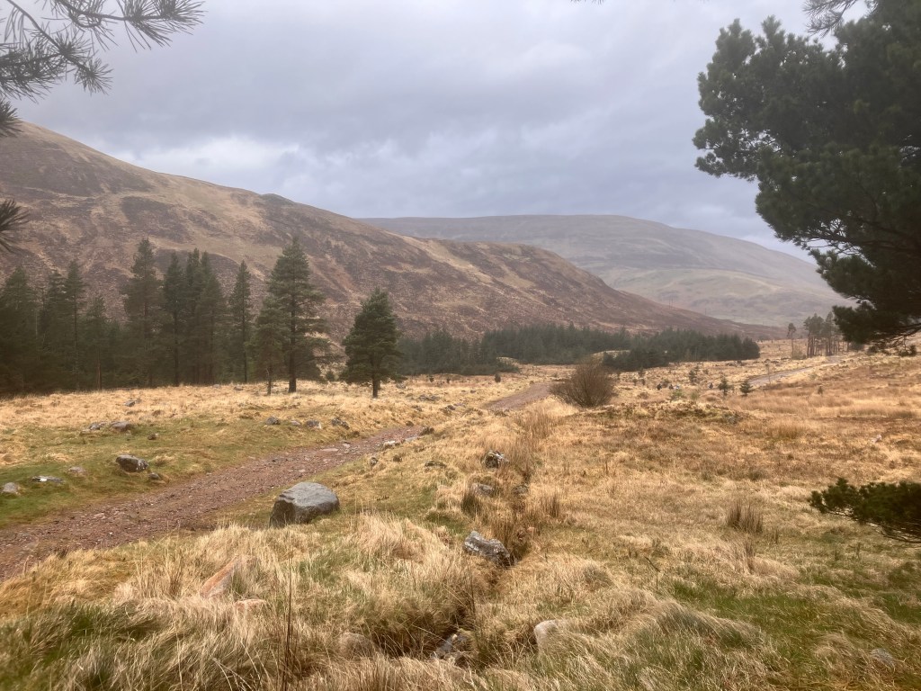
As promised by the guidebook, the walking was easy with a good wide path and mostly flat. We always knew today would be just about getting the miles done; the rain was an incentive to do it faster.

Heave away, haul away.
Drat. That song again.
We’re bound for South Australia.
We’re bound for Fort William, actually.
And this open landscape gave us very little cover. Luckily the rain was straight down rain, not windy rain. The prospect of walking for seven or eight hours with rain blowing into my face the whole way would almost be enough incentive to go back to Kinlochleven and get the bus.
Almost.
We were not quite two hours in when we reached a spot with some shelter – the ruined cottage.

“This building is dangerous. Do not enter.”
We could see hikers looking at the sign and making a judgement – getting out of the rain for a bit or potentially getting crushed by a collapsing building. Most, like us, sheltered by one of the outside walls that gave only a little shelter from the rain, but it was enough space to have a snack and some water before continuing on.
We were making good time today, more or less in line with guidebook’s schedule. This is the difference between dawdling, stopping to admire the scenery and taking photos; and marching like you’re on a mission because it’s raining. There must be people who walk the Way and get rain every single day. I felt sorry for them.
It was getting on to lunchtime, and we had our eyes peeled, looking for somewhere sheltered to sit and eat. There were not many options, so when we saw a stand of a few trees at the side of the path, we headed in, found some reasonably comfortable rocks to sit on, and had a rest while munching on our sandwiches.
The rain was continuing and showed no sign of stopping. Being under the shelter of the trees was a welcome break from the constant feeling in being rained on.
But the nature of a break is that it is only a temporary thing, so on again with the bags and back out into the rain.
We marched on for two hours, rain continuing unabated. We felt warm and dry inside our layers but we could feel the weight of the water somehow making everything heavier.
The path threw some surprise hills at us, one described in the guidebook as an “unwelcome steep hill”. I can’t picture many times when a steep hill is welcome.
We knew we were getting closer to Fort William when we started to see forest. Some standing, some cleared. A flat wide forestry road offered an alternative path to Fort William but it was misleading, actually longer than the real path according to a information board we found in the middle of nowhere.
“Are you walking the West Highland Way? Please fill in our brief survey.”
I’m normally a fan of surveys but the bizarre placement of this one in the middle of nowhere, then needing to take off my backpack and try to find a pen, then having to stand in an unsheltered spot and fill out a questionnaire while the paper got splattered with rain… no, sorry, not today.
A thick stand of pine trees provided another opportunity for us to shelter and eat our second round of sandwiches. We were not particularly hungry but we had carried these sandwiches from Kinlochleven. We didn’t want to carry them all the way to Fort William. Every day we carried so much food with us but only ate a small amount of it.

From our sheltered spot out of the rain, we watched other hikers stop at the way marker that said “West Highland Way” pointing back the way we had all come. We watched the concerned conversations, before everyone decided this sign was for people walking north to south, and continued on the path.
Rain doesn’t hurt but when you’ve been in the rain all day, and then had a break from it, even a short one, it feels almost like mild pain to go out into it again.
But we knew this was the last leg of the last leg. In a few hours our time on the Way would be over.
There was no time to be sad. We still had some miles to go.
Ben Nevis loomed out of the cloud, a red lump, the summit appearing and disappearing as the cloud rolled over its blunt and slightly snowy summit.
The path rolled downhill, a wide gravelled road, easy walking. We knew we were getting close to Fort William when we saw dog walkers; lots and lots of people with dogs.
We passed the path leading to the youth hostel, and then reached the Braveheart car park. Decision time, except we had already discussed and made our decision some time ago.
The West Highland Way is notorious for petering out in a disappointing way. You come down out of the hills, after days of trekking through some gorgeous scenery, and the path leads you to a footpath beside a main road, through a roundabout and down the main shopping street of Fort William. Not pretty, not scenic and not a great way to end an epic journey.
Our guidebook suggested a better end, following the Cow Hill circuit. There were two Cow Hill options but we had decided to take the easier one, not wanting to have a steep uphill climb last thing on our last day.
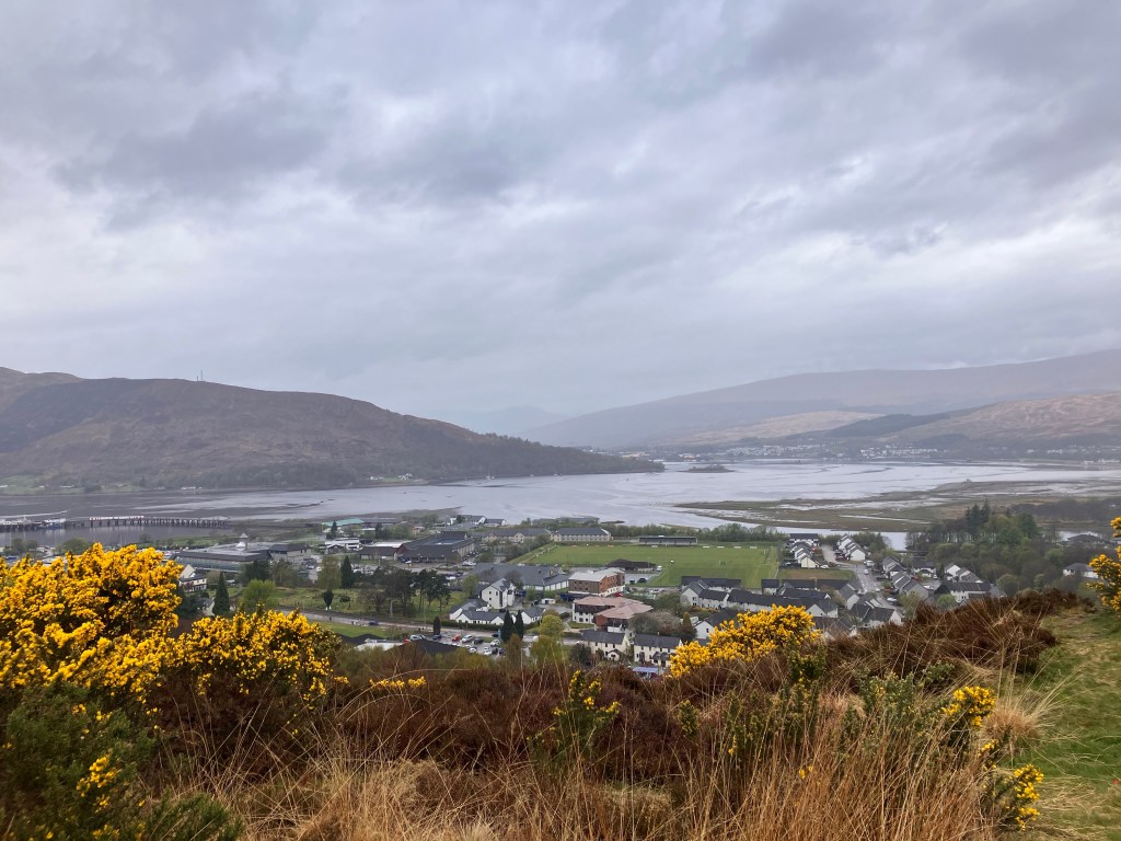
That said, the lower / easier path still had a short (and steep, of course) uphill climb, but this brought us up above Fort William with views across Loch Linnhe, a marvellous view despite the dreich weather. The Cow Hill path led us through scrub, and then along paths lined with fragrant gorse. I breathed in deeply, grabbing as much of that fresh fragrant air as I could, while I could.
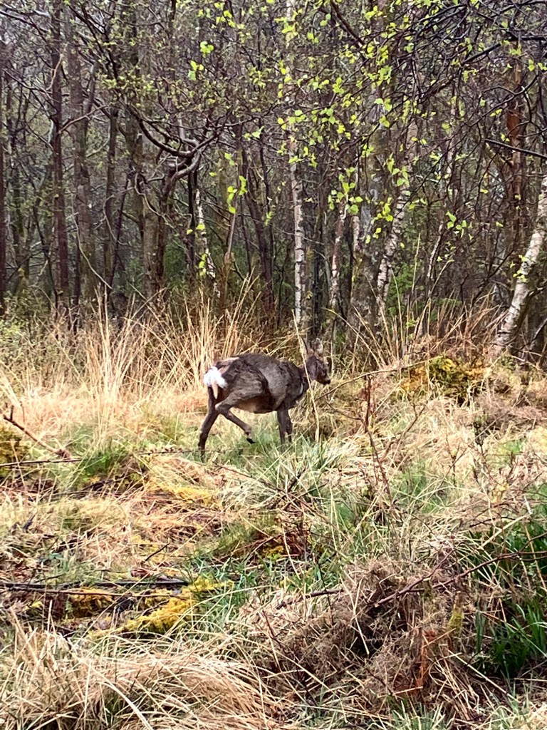
We were up high enough to not feel how close we were to the town of Fort William and we were close enough to the forest to come across a grazing roe deer.
But we were close to Fort William and sadly to the end of the Way. The Cow Hill path eventually pointed us away from the path and up into the outer suburbs. There is no magic way into town, all paths involve some road walking. We had at least chosen walking through the suburbs, weaving downhill again, the houses becoming grander (and more likely to be hotels, guest houses and B&Bs) the closer we got to Fort William’s high street.
Eventually we weaved our way onto the high street where the citizens of and tourists in Fort William were out and about in the shops. It felt strange to be amongst people doing normal things, people dressed normally.
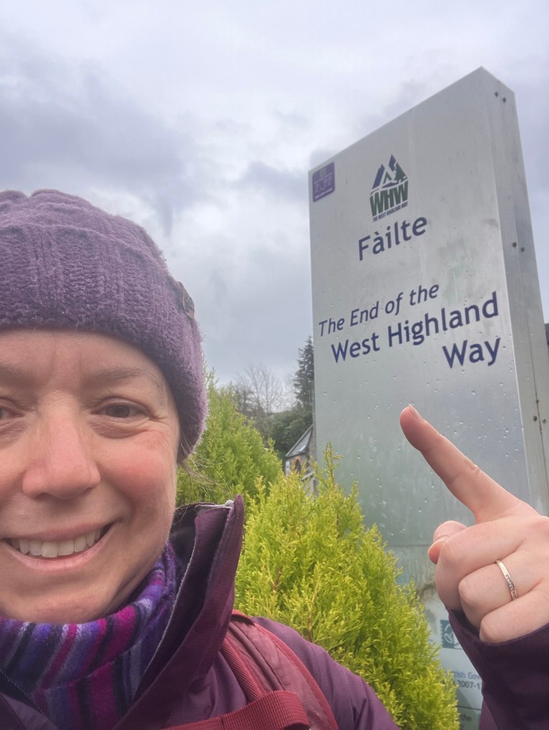
And there it was, the square with the statue of the man with the sore feet. The official end of the Way.
I felt a wave of emotion. Ninety six miles – I’d walked it, I’d completed the Way. I felt tears forming, this was a momentous moment, something I wanted to treasure.
“Hurry up and take your photos,” Husband said, “then we can get to the B&B, get out of this rain and have a cup of tea.”
Buzzkill much?